Calving Front Location
Calving Front Location
The calving front location (CFL) is a fundamental climate data record, and rapid changes can indicate changing boundary conditions or ice dynamic imbalance. The CFL also serves as a practical boundary of the Antarctic coastal margin and is required input for ice flow modelling, studies of calving processes and their driving forces, for computing mass fluxes and ice shelf mass balance, or for mapping glacier and ice shelf area change.
Building on work that started in STSE CryoSat+ CryoTop Evolution and continued in Polar+ Ice Shelves we propose the further development and temporal and spatial extension of the so-called elevation-edge method for CFL derivation (Wuite et al., 2019). This method is based on the premise that an ice shelf edge is usually a steep ice cliff that is clearly resolved in surface elevation data. The algorithm applies edge detection and vectorization of the sharp ice edge in gridded elevation data from CryoSat-2 (CS2) swath altimetry to automatically generate vector shapefiles of the calving front.
For more complex calving fronts with iceberg melange at the ice edge, and on spatially smaller glaciers (< 3 km wide) such as those found on the Antarctic Peninsula, the spatial resolution of CS2 limits the use of this method for CFL delineation. In these regions we will pilot the use of deep learning to map the calving front location using Sentinel-1 SAR data.

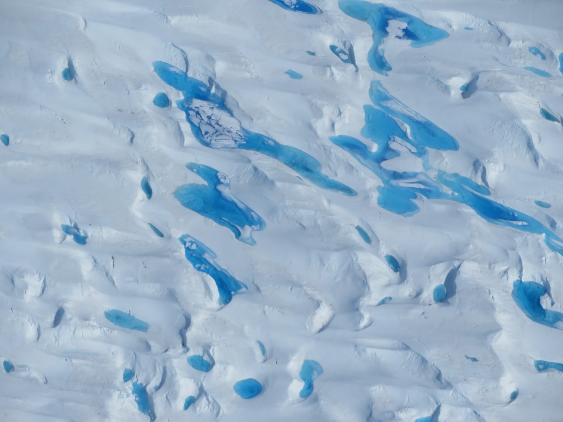
Annual CFL’s of Amery Ice Shelf based on the elevation-edge method for the period 2011-2020.
Summary of calving front location datasets planned within 5DAIS:
- Extend the existing CS2 CFL products in both time and space to cover the major ice shelves around the continent during the entire mission duration of CS2 at regular intervals.
- We will pilot the use of deep learning applied to S1 data to generate a high spatial and temporal resolution calving front dataset for smaller tidewater glaciers and complex calving fronts on the Antarctic Peninsula